


Offline Waypoints Free
Offline Waypoints Free의 설명
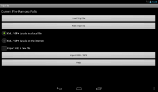
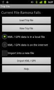
Offline Waypoints was designed from the ground up as an offline maps and way point solution. Plan your trip using the App, Google My Places, Google Earth, or any software that allows for KML or GPX exports.
After you import or create your waypoints you can easily download all of the map information you need for your journey with just a couple of buttons when you have an internet connection. This will save you money (sometimes hundreds of dollars) by avoiding roaming fees when you leave your service area. It will save you from getting lost when you are going somewhere without service at all.
There is no need to spend time selecting areas for download. There is no storage space wasted by downloading unneeded map data.
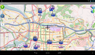
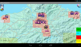
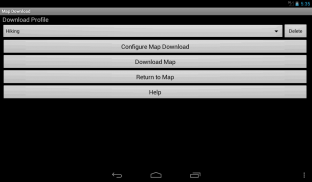
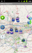
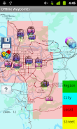
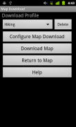
Offline Waypoints downloads the map area around the waypoints in your trip. Select how far away from each waypoint to download map data by your activity type (hiking, driving, city walking, etc) or using your own custom settings in an easy to use screen.
Here is a list of the features found in this app:
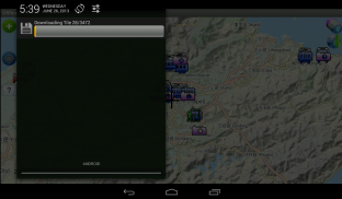
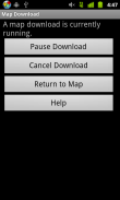
- Downloads map information as a background process so you can do other things with your device.
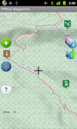
- Get a preview of where information will be downloaded before starting the tile download process.
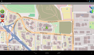
- All way point information is stored offline on your device's external storage space. There is no need to be online once the map data is loaded.
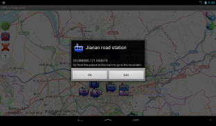
- Add new way points using the coordinates on the screen cursor, or your current GPS location.
- Way points are easily edited with on screen controls.
- Set how long for the app to retain GPS lock when the App is not in use for areas where it is hard to get a lock.
- Regain storage space by selecting previously downloaded map areas to delete.
Note on Google Maps:
Due to it's license for use, Google Maps tiles can not be stored locally. This app is meant as an offline map solution. However, if there is enough support I can add a Google Map Layer that is online use only.오프라인 웨이 포인트는 오프라인지도와 웨이 포인트 솔루션으로 처음부터 설계되었습니다. 앱, 구글 내 위치, 구글 어스 나 KML이나 GPX 수출을 허용하는 소프트웨어를 사용하여 여행을 계획.
당신의 웨이 포인트를 가져 오거나 작성 후 인터넷 연결이있을 때 당신은 쉽게 당신이 단추의 다만 몇 당신의 여행에 필요한지도 정보를 모두 다운로드 할 수 있습니다. 이것은 당신이 당신의 서비스 지역을 떠날 때 로밍 요금을 피함으로써 (달러의 때때로 수백) 당신에게 돈을 절약 할 수 있습니다. 그것은 당신이 모두에서 서비스를하지 않고 어딘가에 갈 때 길을 잃지에서 당신을 저장합니다.
다운로드 영역을 선택하는 시간을 보낼 필요가 없습니다. 불필요한지도 데이터를 다운로드하여 낭비 된 저장 공간이 없습니다.
오프라인 웨이 포인트는 여행의 중간 주변지도 지역을 다운로드합니다. 귀하의 활동 유형 (하이킹, 운전, 도시 산책, 등) 또는 화면을 사용하기 쉬운 사용자 정의 설정을 사용하여지도 데이터를 다운로드하는 방법 멀리 각 웨이 포인트를 선택합니다.
다음은이 응용 프로그램에있는 기능의 목록입니다 :
- 백그라운드 프로세스로 다운로드지도 정보 그래서 당신은 장치와 함께 다른 작업을 수행 할 수 있습니다.
- 정보가 타일 다운로드 프로세스를 시작하기 전에 다운로드 할 위치의 미리보기를 가져옵니다.
- 모든 웨이 포인트 정보는 장치의 외부 저장 공간이 오프라인으로 저장됩니다. 지도 데이터가로드되면 온라인 상태 여야 할 필요가 없습니다.
- 화면 커서의 좌표를 사용하여 새로운 방법의 포인트, 현재의 GPS 위치를 추가합니다.
- 웨이 포인트는 쉽게 화면 컨트롤에로 편집되어 있습니다.
- 기간 설정 앱이 잠금을 얻기 어려운 지역에 사용하지 않을 때는 GPS 잠 유지하는 응용 프로그램에 대한.
- 삭제 이전에 다운로드 한지도 영역을 선택하여 저장 공간을 회복.
Google지도에 대한 참고 사항 :
사용을 위해 면허증으로 인해, Google지도 타일은 로컬로 저장할 수 없습니다. 이 응용 프로그램은 오프라인지도 솔루션으로위한 것입니다. 이 경우에는, 충분한 I 온라인으로 만 사용됩니다 구글지도 계층을 추가 할 수 있습니다 지원합니다.
Offline Waypoints Free - 버전 1.7.2
(29-06-2015)Offline Waypoints Free - APK 정보
APK 버전: 1.7.2패키지: com.rjs3software.OfflineWaypoints.FreeOffline Waypoints Free의 최신 버전
다른 버전들


동일 카테고리의 앱


좋아할 만한 것...


